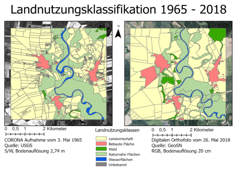
Within the framework of a bachelor thesis and in cooperation with the junior professorship for environmental remote sensing, land use changes in the model region of ECO²SCAPE were evaluated. For this purpose, a satellite image from 1965 was classified and compared with a digital orthophoto from 2018. The evaluation shows that the size of agricultural land has tripled, while the length of field boundaries has halved.